
|
Previous - Home page - Family selection -
Size selection -
Summary table -
Study sites References - Acknowledgments |
Click on the star to see the specified site
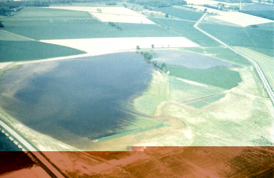
The Dombes |
|
Situated in the East Centre of France, the Dombes is a large clay plateau with more than one
thousand fish farming lakes of a total water area exceeding 12 000 Ha. This artificial ecosystem
is closely connected with human activities (fish farming, agriculture and hunting) that influence
the management of each lake. Scattered in a landscape actually very marked by cereal growing, the
lakes offer natural diversified habitats: reedbeds, mudflats, rushes, aquatic plants.
In contrast to other French fish farming lakes, the lakes at Dombes are regularly dried up where oats
and corn are often cultivated. This area is one of the main sites for the reproduction of waterbirds
in France, though the populations of ducks have been suffering a collapse since the seventies. T
he ducks nesting there are the Mallard (Anas platyrhynchos), the Red-crested Pochard (Netta rufina),
the Common Pochard (Aythya ferina).and in a lower quantity the Gadwall (Anas strepera) and
the Tufted Duck (Aythya fulligula). The geographic location of the Dombes on a major migratory axis
makes it a favourable reception for an exceptional migratory avifauna. |
 |
 |
La Brenne |
|
The Brenne is also a lake area which that harbours an exceptional biodiversity.This area of about
100 000 Ha is characterised by 2237 lakes covering more than 8 000 Ha of water. Their number has been
in constant increase over the last 40 years, since there were 600 lakes covering an area of 5600 Ha of
water in 1950. These lakes are destined to fish farming and thus they have a great socio-economic and
cultural interest. The Brenne is a mosaic of different habitats (lakes, woods, moors and wet meadows),
which favours a great botanical richness, particularly at the gently slopes of the water edges of the lakes.
These artificial lakes have been built for the first ones that date from the XIth century when fish farming
started in the region. Traditionally extensive, the pisciculture has greatly increased its importance in recent
years , which has led to the important damage to the natural patrimony of the lakes. Every year from October
to February, these lakes are emptied and fished. They are also used for hunting on waterbirds.
The Brenne forms a restricted area that welcomes an important population of wintering ducks:
the Mallard (Anas platyrhynchos), the Common Teal (Anas crecca), the Northern Shoveler (Anas clypeata),
the Gadwall (Anas strepera), the Common Pochard (Aythya ferina) and the Tufted Duck( Aythya fulligula).
|
 |
The Rochefort marshland |
|
This marshland covers an area of about 120 000 ha between the Charente estuaries on the north
and the Seudre river on the south and facing Oleron island. It has come to be as the result of the
simultaneous action of geological transgression and human action creation of salt marshes. The Rochefort
marshland is a soft and very parcelled area with a microrelief of mounds, pits, natural meadows (90%) and
a small areas of cropping (wheat, corn) and fallow land that are occasionally liable to flooding.
A gramineous vegetation predominates in the mounds and pits where there is a diversified vegetation
dominated by halophytes. The Rochefort marshland is also a very important area for the wintering and
the migratory stages of waders and ducks. |
|


